
Tradera J.R.R. Tolkien, Pauline Baynes, A Map of Middle-earth (stained)> Plakater
Original price was: kr.6.90.kr.6.83Current price is: kr.6.83.
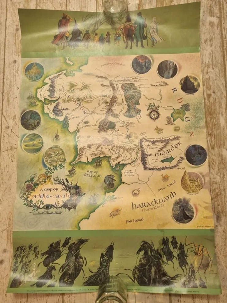
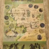
A Map of Middle-earth (name on map), also known as the Pauline Baynes Map, is a poster-map of Northwestern Middle-earth originally published in 1970 by George Allen & Unwin. This copy was printed in 1986.
Please note the stains (photo), likely a result from exposure to water/humidity at some point. In my opinion, though, the map would still look lovely in a frame.
I will pack it in a tube cardboard package. Because of often prohibitive costs of shipping tube packages, I have initially limited the sale of the poster within the EU. Feel free to contact me, however, if you're intending to bid from outside the EU, but please be aware of import charges and additional shipping costs. I will of course also answer any questions about the poster and provide more photos.
—
Based on the map of Middle-earth first published in 1954, the poster-map (created in 1969) was a collaboration between Pauline Baynes and J.R.R. Tolkien. Tolkien corrected a few errors on the original map and supplied some additional place names and notes on nomenclature.
"New" locations include: Dorwinion, Eryn Vorn, Andrast, Drúwaith Iaur, Undeeps, Tumladen; the towns Framsburg, Edhellond, Lond Daer; and the rivers Adorn, Glanduin and Swanfleet (labelled as a river). Other additions include wooded areas in Eryn Vorn, Enedhwaith and around the river Isen, not indicated as such in earlier maps. The "Éothéod" are also labelled, indicating their original homeland (near Gundabad).
The name of the Grey Havens is labelled, but unlike in the earlier maps, their location is not indicated with an icon. Sarn Ford is labelled simply as "Ford". The Sea of Rhûn is now all occupied by water, whereas the earlier (as well as the later) map by Christopher Tolkien indicated that it contained an island.
—
Säljer delar av min Tolkiensamling. Samfraktar. Skick enligt foton, skriv gärna om du vill ha mer info om auktionen.
Be the first to review “Tradera J.R.R. Tolkien, Pauline Baynes, A Map of Middle-earth (stained)> Plakater”
Related products
Alt Indenfor Andet
Alt Indenfor Andet

Alt Indenfor Byggeri Og Værktøjer

Alt Indenfor Antikviteter Og Design
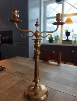
Shop Art Deco Ljusstakar 1-par Art People Gallery Sweden Øvrige Antikviteter & Design
Alt Indenfor Andet
Shop morsø jiko Udekomfur Helt ny i pakken Boliger Og Lokaler
Alt Indenfor Byggeri Og Værktøjer
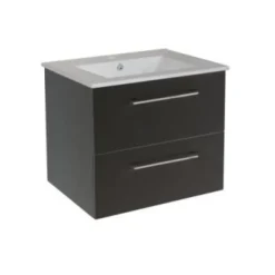
Discount KOMMODPAKET BATH DELUXE CAMDEN SVART 60 CM Badeværelse

Alt Indenfor Antikviteter Og Design
Fashion Saltripa i horn – Lars Pirak – Jokkmokk Kunsthåndværk

Alt Indenfor Antikviteter Og Design

Alt Indenfor Andet

Alt Indenfor Antikviteter Og Design

Alt Indenfor Byggeri Og Værktøjer
Clearance Husqvarna mörkgrå huggarbyxor sågbyxor Beskyttelsesudstyr & Beklædning
Alt Indenfor Antikviteter Og Design
Hot Orientalisk matta – 298 x 178 cm – Vävd matta Gulvtæpper

Alt Indenfor Andet
Reviews
There are no reviews yet.